

The topics in this travel report:
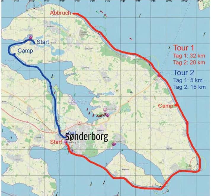
A few SUP detours along the Danish coast are already in my wake, nautically speaking. I've even circumnavigated a real island, albeit only around Årø, a small island at the end of Haderslev Fjord. However, I finally wanted to tackle something more challenging without having to travel too far. Sønderborg is 45 kilometres by road from my home town of Flensburg on the Flensburg Fjord and is a perfect starting point for a circumnavigation of Als. It should be possible to complete the 90-kilometre loop in four to six days, weather permitting. With this vague plan in mind, I pack up my gear, load the board onto the roof rack and say goodbye to my wife, bursting with energy, with the words "I'll be done in six days at the latest." Things turned out differently.
Act 1: Warming up
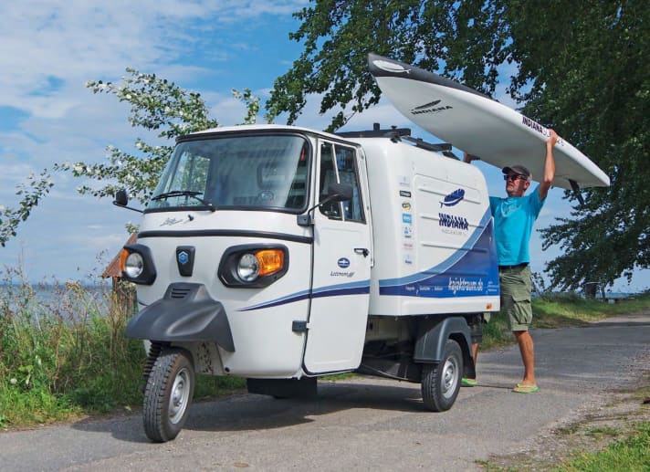
As if it were a matter of honour, I decide not to drive over the bridge in Sønderborg to the island and park my Ape-Classic on a small beach on the mainland side. An urge to move that has built up for too long needs to be satisfied. So luggage on the board and off I go. I paddle south-east towards a large marina and leave the town of 30,000 inhabitants behind me after just three kilometres. The landscape changes abruptly. A moment ago, the shore was still characterised by hustle and bustle and dense buildings. Now a dense beech forest stretches right up to the water's edge. The conditions are so ideal that I fall into a rhythm that resembles a smoothly running machine. Something is also happening in my head. The control centre reports: "Everything's fine!" "If it stays like this," I motivate myself by talking to myself, "it'll be a fast one."
The Kegnæs peninsula is the southernmost tip of Als. You could also pass it on the north side through the entrance in the direction of Hørup Hav and then cross the 50 metre narrow causeway over land at Drejby. But that would be cheating. If you want to round Als cleanly, take the route around the outside. At least that's what the referee in my head says, whom I still accept as an authority up to this point. A light north-easterly wind slowly makes itself felt, which doesn't really slow me down, but does have a noticeable braking effect during short paddle breaks. The narrow, deserted beach has been tempting me to treat myself to a rest for some time now. As there are no fixed breaks defined in the rules of my head referee, I allow myself my first shore leave after ten kilometres, having more than warmed up.
Location, location, location
Fortunately, the wind makes no attempt to freshen up. On the contrary. It almost falls asleep. The lack of break regulations can therefore be utilised. Als' south coast is unspectacular, but still has a very special charm. Perhaps it is the largely unspoilt, narrow stone beaches, wild vegetation or fallen trees that are allowed to remain here without the resort administration deeming it necessary to clear them up. The landscape looks wild and is allowed to be what it is: just there. Gliding past it on a SUP board is a combination of workout and soul therapy.
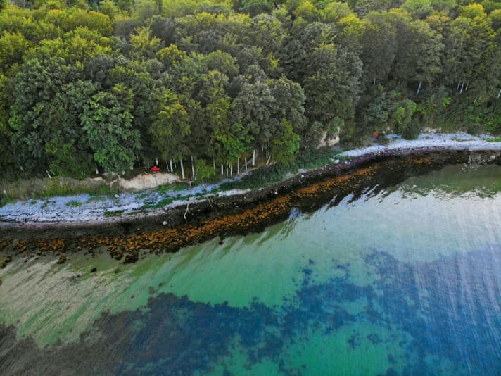
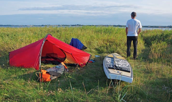
I'm amazed at the strength you can develop - at least in terms of stamina. Despite several chocolate bars that I've refuelled with in the last two breaks, the machine is now threatening to show the first signs of fatigue. Time to find a place to spend the night. Three kilometres north of Mommark, with over 30 kilometres in my shoulders, I check in, replacing the routine at a reception desk with setting up my tent, and nobody is interested in my credit card. And all this in a place that estate agents would probably classify with three words: Location, location, location. My terrace: a slightly elevated section of bank between old beech trees. My admittedly somewhat cramped abode: a piece of fabric that spans less than two square metres. The view: unrivalled, with no buildings to obscure it, across the Baltic Sea to the horizon. Only for a short time, but who knows what tomorrow will bring?
Heavy Metal in the North
Chaffinches and their communication-needy colleagues in the trees replace the alarm clock. Well rested and equipped with a new boost of motivation, my first official act is to check the weather. The sky and water make a clear statement here and now:
"Come on, then. It's not going to get any better." The weather app proves to be the antithesis, announcing a freshening north-westerly wind in the afternoon. I surrender to what I see in front of me and punish the weather forecast with ignorance. 45 minutes after breakfast, I'm ready to go to sea. Back on the water, I put my musculoskeletal system into warm-up mode. After half an hour, a stable stroke rate sets in, taking me along at just over six kilometres per hour. That suits the timetable. Fynshav, the ferry harbour that connects Als with the islands of Ærø and Fyn, comes into view. Two kilometres further on, I pass the Taksensand Fyr lighthouse. The lighthouse was put into operation in 1905. Until 1953, the structure was 13 metres higher. In 1953, it was decided to reduce its height to 19 metres as part of repair and conversion work. This seems to be sufficient as a landmark for ferries and pleasure craft, especially as the distance to Ærø and Fyn from here is only 16 and 11 kilometres respectively. The nominal range (visibility of the light under normal conditions) of the light exceeds 20 kilometres.
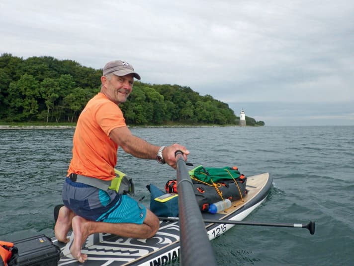
After Taksensand Fyr, I realise that I need to curb my optimism. The coast still offers enough wind cover for me to paddle at an acceptable speed. But even a slight course correction to the west leads to a standstill if the paddle is dropped even briefly. The only thing that helps is to increase the pressure on the paddle blade and paddle close to the shore. You still need to take a break. My back and shoulders are at least signalling a need. On land, I stretch out, whistle in two bars and enjoy the peace and quiet, which is only accompanied by a subliminal background sound created by the gurgling of small waves between the pebbles of the Als beach.
The further north I go, the more obvious it becomes that I can forget my euphoric goal for the day of getting around the northern tip of Als. What the weather forecast had predicted materialises. The north-westerly wind picks up and puts me to the test. If I let the distance to the shore get too great, fresh gusts make it unmistakably clear to me that I'd better head back towards the shore. To stick with musical comparisons: The lulling, rippling background melody of my first break has turned into an aggressive heavy metal sound ten kilometres further north, which really gets on my nerves. I almost only paddle on the right-hand side so as not to drift any further from the shore. My shoulder hurts.
I'm not receptive to scenic attractions at the moment. I'm putting all my energy into generating halfway forward momentum, which seems increasingly pointless. That's it, that's it for today! I go ashore near the Lavensby Strand campsite. A final weather check leads to plan B: cancellation. According to the wind finder, we can expect even more pressure from the north-west over the next two days. The circumnavigation of Als' North Cape has thus been cancelled. I hitchhike back to Sønderborg, pick up my tricycle and make my way home. However, I leave behind a promise that I shout into the wind before I stubbornly slam the door shut: I'll be back!
Act 2: Anything goes, nothing must
With an open-ended plan, I pull my board off the roof rack in Dyvig at the far end of Stegsvig bay. The Als Fjord is relatively sheltered and if things go well, I might make it as far as Sønderborg. Dyvig lies to the north of Als on the west side, a little further inland on the island. I want to spend two days travelling without any major pressure to reach my destination and won't decide until tomorrow morning where this trip might take me. If it remains a Stegsvig round trip, that would also be a worthwhile micro-adventure. If the weather permits, a longer course through the Als Sound to Sønderborg would also be possible. It's late afternoon in August. The sun is moving westwards as I paddle towards the Als Fjord. Just find a nice spot for the night - that's all there is to do today.

The wind-protected and scenic waterway between Dyvig and the Als Fjord is an excellent starting point for a SUP trip. From the right, a long, narrow headland narrows the waterway to a width of 40 metres. A small farm on the south side faces the flat land to the north. The landscape behind the bank is characterised by cultivated fields. From my vantage point, however, I can't see much of it. On both sides, I can see sections of the bank, some of which are overgrown with small trees, which move further apart with every stroke of the paddle and give my gaze more and more space.
After reaching the Als Sound, however, I have to force myself to scan the lovely shore with more focus. Finding a nice spot for my tent is now on the agenda. After a quick left turn, I discover my own personal place to be. I land, take a few steps, look around twice and it's clear that the search for accommodation is over. Perfect! My first judgement can be extended to the whole evening, which I spend deeply relaxed on a wild meadow between reeds and a strip of dog roses. Before I enter into an intimate relationship with my sleeping bag, a sip of red wine runs down my throat instead of a bedtime story. Life could be worse.
Not to be missed: Nydam Tveir
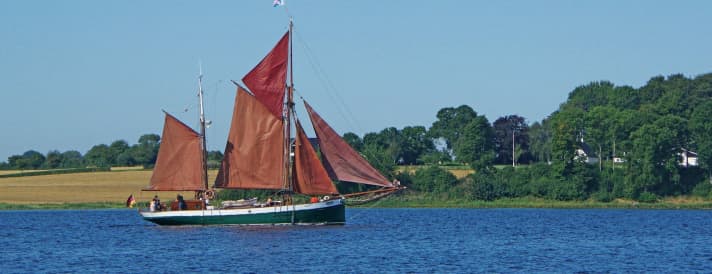
"Right," I say as captain, navigator and boatswain in one, after I have taken the information from Windfinder that was decisive for the course. To where? To Sønderborg! Only a very light breeze ruffles the water and I join the maritime community heading towards Augustenborg and Als Fjord. Most of them are on their way under sail. I seem to be the only one using muscle power to get around here today. Faster, by the way, than all the sailors who do without engine power. The sun's rays caress my nose and, despite the early start, I start to sweat.
Directly at the entrance to Als Sound, the boatman announces the need for a break at the sight of the left bank. The navigator and captain agree after eight kilometres. Not a cloud in sight. The homogeneous blue of the sky is reflected as a mottled carpet on the surface of the sound. The opposite shore is a green wedge between the sky and the water. In conditions like these, energy replenishment must be combined with enjoyment. I dig out the cooker and pot from my luggage, serve myself a coffee a little later and devour a bar of chocolate that would otherwise have been at risk of thermal deformation.
As soon as I'm back on the board in the centre of the fjord, I spot an interesting boat on the western shore and head straight for it. The Nydam Tveir, a true-to-scale replica of the famous Nydam boat, which is the oldest known ship of this type, is moored on a jetty leading far out into the fjord. It is thought to have been built around 340 AD. According to current knowledge, it does not fit into the Viking Age, which is thought to have begun in the 6th century at the earliest. The dimensions are impressive: 23 metres long, 3.4 metres wide and weighing 4.4 tonnes. The original was found nearby during excavations between 1859 and 1863 and can now be seen reconstructed at Gottorf Castle. This ship can be moved by up to 30 oarsmen. It has no mast and no sail. The propulsion therefore works in a similar way to a SUP board. However, the dimensions are very different. You could weigh this ship at around 350 SUP boards. The original is said to have been used as an ocean-going fast troop carrier that could carry up to 45 men. The "Nydamselskabet" association (nydam.nu) completed the Nydam Tveir in 2013.
If you would like to take a closer look at the ship, here are the coordinates: 54°58'15.18 "N, 9°44'49.03" E.
There is another way
I still have about seven kilometres to go to Sønderborg. The high bridge that spans the Als Sound serves as my orientation. The maximum clearance height of the Alssundbroen is 33 metres. I catch up with a German sailor who seems a little startled when he hears my loud "Moin" from the left. "Well, where did you come from?" Grinning, I make a slight movement of my head backwards: "From the north." I hold on to his sea fence with one hand. Still confused, he wants to know exactly what I'm doing and points to my unmissable luggage. When I briefly explain how I'm travelling and where I started, he scratches his three-day beard, sways his head back and forth and finally says: "Well, there are obviously other ways of doing it, somehow more reduced. You just have to know what you want." Somewhat incredulously, he enquires more closely: "And you really have everything with you? Tent, sleeping bag, cooker and so on?" "Yes, everything is small and light and not as comfortable as yours. But it works." Now the skipper laughs, raises his right thumb, nods several times and concludes his preliminary assessment with a "Respect!". I push off again to continue paddling at normal speed. "See you later," I call back and overtake the yacht. "Have a good trip," the sailor replies and has to let me go.
Just 300 metres past the Alssundbroen, I reach the flat jetty of the Sønderborg Kayak Club. I know from previous kayak tours that you can spend the night here. I ask a paddler who is obviously about to put his kayak in the water and shortly afterwards I am given a club key. I have to pay a small fee and in return I am generously allowed to pitch my tent, take a shower and stock up on cold drinks from the fridge at a fair price. Pure luxury!
Oh how beautiful Sønderborg is
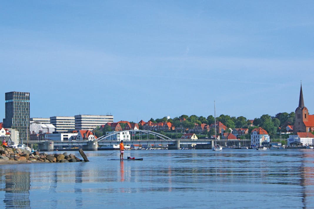
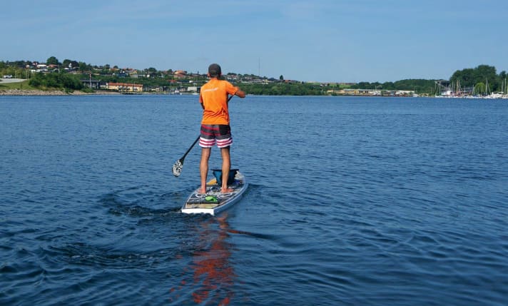
Compared to the forced ending of my first Als act, Sønderborg welcomes me very differently. I actually wanted to make my way back to my Ape straight after the second night. However, a glance at Sønderborg's harbour silhouette and the sparkling light reflections that make thousands of little stars twinkle on the calm fjord make it difficult to say goodbye abruptly. In fact, I still have to close the short gap of just two kilometres between the start of the first act and my current position. Without my luggage, I get back on my board and take a spin around the harbour. There's no better way to end a tour through the Als Sound and having a score to settle - the northern part of Als is clearly still on my to-do list - is perhaps not such a bad thing.
Info round the island As
Waters, weather
The island of Als offers pretty much everything in terms of scenery and sporting challenges that should appeal to SUP tour enthusiasts with an affinity for salt water. However, caution is advised, especially outside the sound. Winds that are too strong can quickly throw a spanner in the works. Taking the wind direction and strength into account should therefore be an essential part of tour planning.
Equipment
It goes without saying that clothing must be suitable for the weather. Depending on the weather, the best way to ensure safety is with a leash. If you want to be even safer when travelling, you can provide additional buoyancy with a suitable life jacket. A ready-to-use, waterproof smartphone is also a good idea.
Best time
Without a doubt: summer. However, tours in late spring or autumn can also be just as exciting. Everyone has to find out for themselves where the time and temperature limits lie.
Spend the night outdoors
In Denmark there are primitive campsites where you can pitch your tent or even use a shelter. Many also on Als. See also web information (udinaturen.dk). The free Shelter App is also very helpful. Some campsites near the water: see web info. Camping may also be permitted in harbours after consultation with the harbour master. Important: ask first, then pitch your tent.
Maps and navigation
If visibility is good, a tour around Als should work without a map. It would also be conceivable to print out a web-based map at home and laminate it waterproof, or simply use a standard app, Google Maps or a GPS device while travelling.
Further web information
- Info As
- Info Sønderborg
- Book Shelter: udinaturen.dk
- Camping Drejby (South)
- Camping Fynshav (East)
- Campsite Lavensby (North)
- Holiday homes on Als: e.g. FEJO
- Sønderborg Kayak Club
