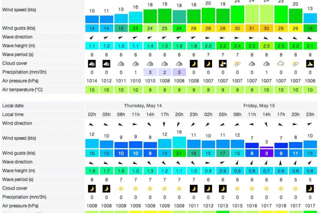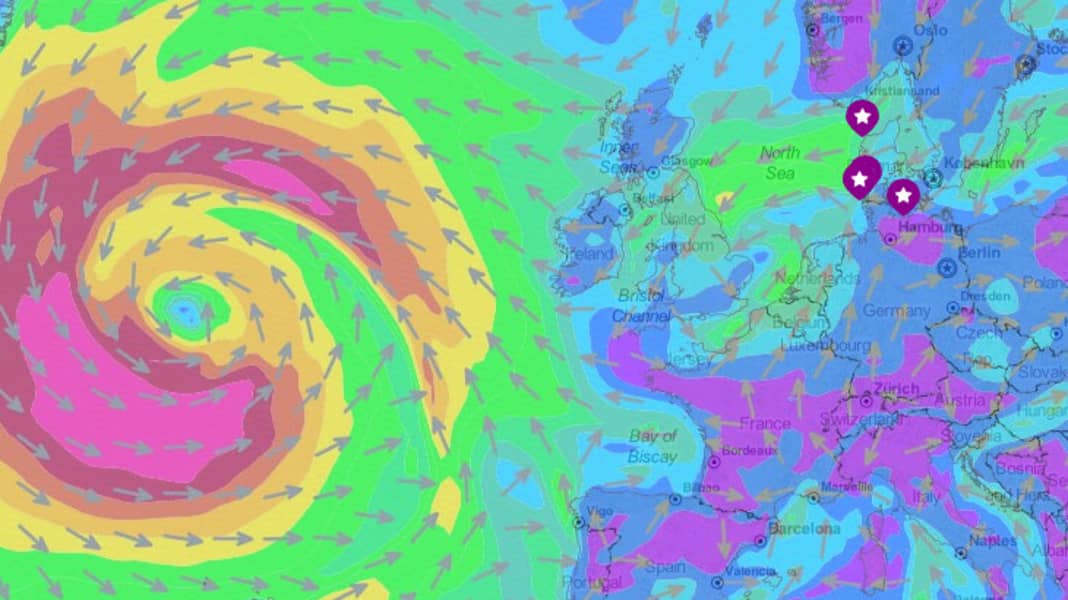
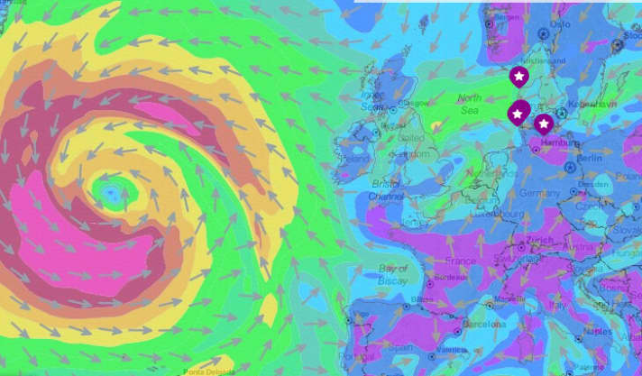
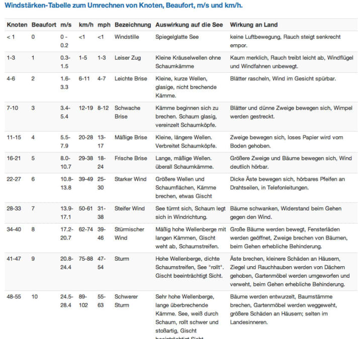
Wind is created by differences in air pressure. The greater the differences, the stronger the equalising movement in the form of wind. The air always flows from places with high air pressure to places with low air pressure. The rotation of the earth prevents this equalisation from taking place directly and ensures the formation of the rotating high and low pressure systems. Wind force is usually expressed in knots (kn) or metres per second (m/s). The colloquial term "wind force" is based on the Beaufort scale, so "five Beaufort (Bft) and "five wind forces" are the same thing. However, the Beaufort scale only ever reflects certain ranges; five Beaufort, for example, characterises everything between 16 and 21 knots.
Here is a conversion table for all common data:
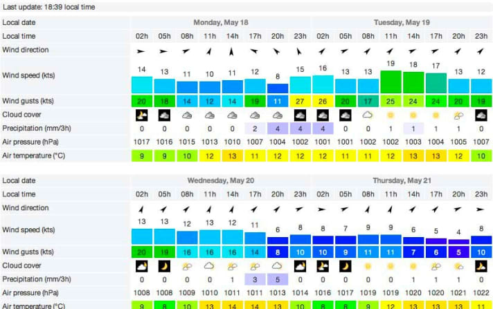
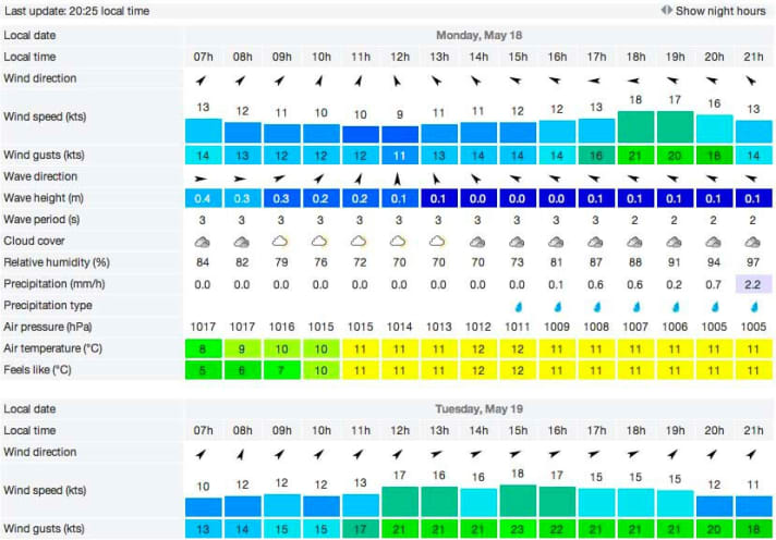
Wind forecasts are based on computer models. These are fed with measurement data - for example from satellites, weather buoys, ship reports and radar - and ultimately spit out a weather and wind forecast. Depending on which calculation model is used, different forecasts are produced from the same measurement data. Each model normally has certain strengths and weaknesses. For example, a high-resolution model may be able to capture local effects such as thermals or jet effects, but conversely cannot provide an overview of the big picture. A coarse model can do exactly this, but sometimes fails due to small-scale and local effects. As a general rule, it is best to check several forecasting services. The more closely the different forecast models agree, the more certain it is that the wind will materialise as predicted. If the forecasts differ greatly, caution is advised and you have to decide which forecast you trust more.
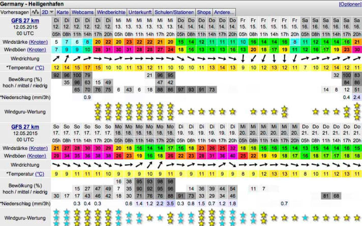
Although many forecasting models still spit out values for long periods (ten to 14 days), it must be clearly stated that meteorologists speak of a "trend" rather than a "forecast" from four days onwards. The accuracy decreases with every day that you go further into the future and fluctuates depending on the weather conditions. If a stable high-pressure phase has settled in, 5-day forecasts are often good, but with frontal weather and westerly winds, the forecasts change almost every hour. So you shouldn't let 14-day forecasts drive you crazy.
On the coasts and in the lowlands, the usual forecasts are often perfect, but on Lake Garda, for example, which is surrounded by mountains, they are regularly completely off the mark. Why is that? Weather models lay a kind of grid over the earth's surface and assign the same values to all points within a sector. In the widely used GFS model, for example, the grid points are 30 kilometres apart. This is not a problem on the open sea, on the coast or in the lowlands because the influence of topographical obstacles is virtually eliminated. The model therefore produces the same forecast for all points within a 30x30 km sector. If you apply the same model to Lake Garda, which is only a few kilometres wide and surrounded by mountains 2000 metres high, the model reaches its limits because it may not even recognise that there is a lake here, let alone that it has its own wind system of mountain and valley winds. For this reason, you should always check local weather services in the Alpine region (e.g. Lake Garda, Swiss lakes, Bavarian lakes), which work with higher-resolution regional models.
