Windfinder: How wind forecasts are created, the difference between forecast and super-forecast
Julian Wiemar
· 10.12.2024
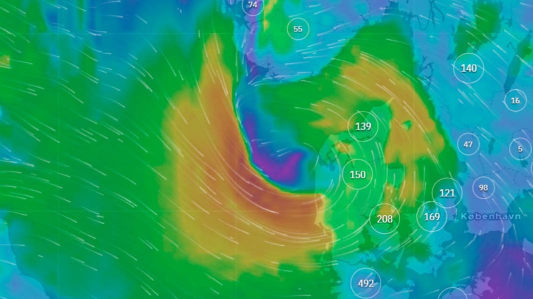
Windfinder was founded in Kiel back in 1999 as a digital-first company (the term didn't even exist back then). Four enthusiastic water sports enthusiasts worked with programmers to develop an SMS forecasting service. Since then, Windfinder has developed into one of the most important forecasting services for water sports enthusiasts. So Windfinder is celebrating its 25th birthday in 2024. Managing Director Jonas Kaufmann told us two years ago as part of the big surf wind special, how the predictions are made.
However, it's not just Forecast and Super Forecast that have become an integral part of modern windsurfing life, but also 20,000 weather stations that transmit wind and weather data in real time. Almost everyone uses the app on their smartphone, tablet or computer. If anyone knows how to read the various forecasts correctly to get the best out of Windfinder, it's Managing Director Jonas Kaufmann. We asked him for a few tips to help surfers avoid constantly getting too excited or feeling misled by the forecast and wasting fuel driving to the wrong spot.
It's been a while since we last visited you, ten years to be precise. What has happened since then? Can you say that wind forecasts have become more reliable in recent years?
Yes, definitely. Wind forecasts have steadily improved. A good forecast requires one thing above all: a lot of CPU power (editor's note: CPU = central processing and control unit of a computer). The performance of processors has improved and become more accessible. Nowadays, for example, you can simply rent large servers. This means that you can calculate models with higher resolutions - like our Superforecast.
And in the company?
We are currently a team of ten water sports-mad software developers, product designers and marketing and support specialists who enjoy using their product themselves on a regular basis. Our apps were still in their infancy when you last visited us, but now they are almost the most important thing for us. What's more, we now have a very strong global presence: the USA is currently number one in terms of hits. Windfinder - whether as a website or our apps - is constantly evolving. We regularly launch surveys and receive suggestions for improvement, which we then incorporate accordingly. Our aim is to create a comprehensive, intuitive tool for outdoor sports enthusiasts to find out about conditions worldwide.
Are you a software developer yourself?
Yes, and what we do at Windfinder is actually software development in many cases. We have a huge amount of data that comes out of the various models and weather stations. Our job is to bring this data to people in a user-friendly format and with a good range of functions.

Where does this data come from?
You have to differentiate a little: The forecast is based on the GFS model of the American weather service, and we calculate our superforecast ourselves on our own servers. The measured values can be seen separately - this is a network that we have built up over the last twenty years. For example, small weather stations at surf schools or important airports.
How does a wind forecast roughly work?
Put simply, an initial state of the atmosphere is first determined. Measured values play a role here, as do satellite measurements or radiosonde ascents. A three-dimensional grid is then constructed over the earth. Based on this, the forecast is calculated using various physical algorithms - in short: how does an air parcel actually move through the atmosphere and how does its temperature and humidity change? And this entire process happens four times a day - these are the different forecast runs.
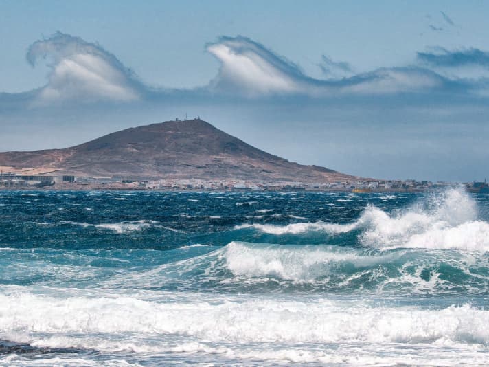
We have all experienced that these predictions are not always 100 per cent accurate. What are your best tips for avoiding the next tailoring trip to the spot with certainty?
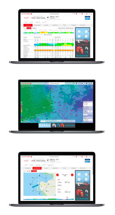
There are some very important points: Get a large-scale overview on the wind map and don't just look at the spot view. The wind field may only just touch the selected spot, but ten kilometres further north or south it may be much stronger. It always makes sense to compare different locations within your radius. If you always stubbornly look at the same spot and only go to that spot, you run the risk of standing on the beach and complaining about insufficient wind. While others have a nice session just round the corner. In general, you should always compare the forecast models in the planning phase of the surf day - in our case the forecast with the superforecast. The more they match, the more stable the general weather situation usually is. This is an important criterion for the probability of the forecast materialising.
Once again for general understanding: What is the difference between forecast and superforecast?
The Superforecast is our high-resolution, regional forecast model for Europe, North America, South Africa, Egypt and the Canary Islands. Because it is regionally limited, we can calculate a significantly higher resolution, i.e. the mesh size of the grid over the earth. In addition, the superforecast uses more advanced physical models that are optimised for wind forecasts. This enables us to better predict even small-scale effects such as cape effects or thermals.
The forecast, on the other hand, is based on the GFS model of the American weather service NOAA. This is available for the next ten days into the future and has global coverage. It is therefore also suitable for longer-term planning. In general, however, we always recommend comparing the forecast models so that you can learn the best possible interpretation of the forecasts for your surf spot.
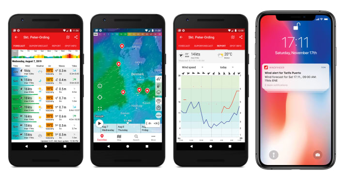
If the two of you are more or less in agreement and you have decided on your spot for the day, but you still have doubts: What can you do before you pack up the car and set off?
You can look at the current measured values on site or in the surrounding area. If, for example, a wind shift from the west is specified in the forecast, you can check whether the stations to the west of the preferred spot are already showing the wind shift to ensure that it will actually arrive at the specified time.
We now also have many spot webcams in the app that you can look at to check whether the trees are shaking on site or whether there are already people on the water - at best, you can even recognise a sail size. There are also storm warnings in the app that you should pay attention to. Will there be thunderstorms? Will the weather be very changeable? Will there be a frontal wind? These are all things you should keep in mind. And don't forget to take a good old look out of the window (laughs). Simply to roughly categorise the weather on the day. Taking all these points into account, you can try to get the best out of Windfinder and thus your surfing day. In other words, to get the best interpretation from the forecast as to when and where to go. And, above all, to avoid the next tailoring trip to the water.
How many days in advance can you look forward to travelling? And when can you pack the van?
It's really difficult to say. Most people start looking in on Mondays for the next weekend. You can do that (laughs). The forecast (GFS) is great for getting a rough overview of whether a low is on its way and whether you should even take a holiday for the next week. Or whether calm is to be expected for the time being. However, I wouldn't pack the van for the weekend until Wednesday at the earliest. Three days in advance gives you a very good chance that the forecast will be accurate.
Despite everything, it is and remains just a prediction. Looking at the sky during the session is more important than any prediction." - Jonas Kaufmann
Is there anything else you would like to say to Windfinder surfers?
Experience makes perfect when it comes to interpreting forecasts. If you check in regularly, compare spots, look at webcams and go to different spots, you will get a good feel for the forecasts in your region over time. Despite everything, it is and remains just a forecast that does not relieve water sports enthusiasts of their own responsibility to keep an eye on the local weather. Looking in the rear-view mirror and at the sky during the session is more important than any forecast.
The big wind special:
- The west wind
- The east wind on the Baltic Sea
- Ora and Vento on Lake Garda
- The foehn in the Alps
- The Meltemi in Greece
- The bora in Croatia
- The sirocco in the central Mediterranean
- The mistral in the south of France
- The Tramontana in the northern Mediterranean
- The Levante in southern Spain
- The trade wind zone
- The roots of the trade winds
- Core trade wind - In the centre of the trade wind
- Passat run-off zone - The end of the Passat
- Interview: Climate researcher Dr Michael Sachweh - "Chasing storms is my passion"
- Windfinder: How wind forecasts are created, the difference between forecast and super-forecast

